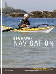
Following on from my review of ‘Sit-on-top Kayak: A Beginner’s Manual’ by Derek Hairon I have just received ‘Sea Kayak Navigation: A Practical Manual, Essential Knowledge for Finding Your Way at Sea’ by Franco Ferrero to take a look at. This is actually a book I have often had recommended by others on the various kayak angling websites and funnily enough I bought it myself a week or two back, having had my appetite whetted by the sit-on-top book.
This is not a read-once-and-be-done-with-it kind of book. It is a manual and also provides exercises to ensure that what you have read you have actually learnt correctly. I have read it through – the day I got it I had to finish it – and dipped in and out here and there – as that is how it is laid out and designed to be read.
Let us begin with the details and the publisher’s synopsis:
Paperback: 96 pages
Publisher: Pesda Press; 2Rev Ed edition (11 Nov 2007)
Language English
ISBN-10: 1906095035
ISBN-13: 978-1906095031
Product Dimensions: 20.6 x 16 x 1.4 cm
‘The first edition (0953195619 which went out of print spring 2007) rapidly became a standard text for sea kayakers. This new edition builds on that success. There are numerous improvements in the explanations and GPS is covered in more detail, reflecting the increased availability and usage of electronic navigational aids. Full use is made of colour photos, diagrams, maps and charts, further enhancing the reader’s experience. Exercises to reinforce and self-assess how much the reader has taken on board are provided at the end of each chapter. ‘Sea Kayak Navigation’ is recommended as support material for the new British Canoe Union navigation courses that are currently being introduced.’
Sounds useful.
 You know what I immediately like about it? It’s the exact same size as Derek Hairon’s book. Of course this is an irrelevance for a review but I do like things neat and tidy like that – it makes the books seem like a set. You see to me a book is not just information – it is an object. Many of my books have become almost like old friends and I must confess that I have a rather good selection of quality books, some signed, many old and a few very rare. I love books.
Physically, the book consists of thin card covers printed in full colour. The front carries a photograph, the rear a photograph and graphic of map and compass. The inner covers carry advertisements (Valley Kayaks and Surf-Lines) and further adverts are printed in the rear – courses, dealers and clothing manufacturers. Once again Pesda Press have produced a high quality book for the price with thick, high-quality matte paper and full-colour printing throughout.
The layout of the book is very clear. A sharp, clear font with easy-to-read line-spacing and a large amount of clear, sharp, well-exposed and colourful photographs gives a feeling of brightness to each and every page. The graphics are simple and well suited – sharp edged photographs occasionally having rounded corners or the application of a drop-shadow, some rapidly faded into the page or cut out. They each come with their own descriptive captions printed in the same size and style of font in blue so they can be easily distinguished.
A lot of graphical illustration is also used and again this is clear and concise. These relate to illustrations of charts, maps, calculations and plans as well as depictions of tidal streams, heights, depths, diagrams and so on. All are easy to read and understand and look familiar to my own charts.
The text itself is broken up into easily-digestible amounts of a paragraph or three and good use of headings and sub headings is made. Additionally, the front features a full contents page and the rear an index. Overall, it’s a very nice-looking book that feels like a quality product. Thumbs up so far!
Now for the content, the important part:
First of all there is an introduction to the author listing his experience as a kayaker to instil confidence in what he has to say. Following on comes a few notes on how to use this book – it is a training manual after all – and then a clear and easy-to-read contents page which, for a manual, is vital. Then we’re into the main body of text:
Keeping it simple:
I’m a great believer in doing just that, being naturally lazy in that I don’t stand when I can sit, and see no point sitting when I can lie down. On a kayak it means I carry less weight and have fewer things to tangle and am less prone to the one mistake that throws everything else awry – a necessity for me as my kayak is already rigged to the gunwhales for fishing and occasionally sailing. So, keeping it simple is an ideal beginning! It also lulls one into a false sense of security as there is a lot of less-than-simple information contained in the ensuing pages. The book begins with: “Ask yourself if you need to do any chart work”. Generally speaking I don’t, other than looking at depths and possible marks beforehand and I tend, at sea, to rely on the fishfinder – using the depth returns with a scan of my chart and a glance at buoy position as reference – but there are times when I would need to make more advanced calculations and this book promises to give me all the information to do just that. This section covers handrails and pilotage – ie following the coast and referring to visible features. Perhaps the simplest means of getting home and one ideal for poor conditions or when you are in an unfamiliar location. The section ends with a practical exercise in map reading.
Decktop Navigation.
This mentions passage planning, equipping the kayak for navigation, charts and maps and plotting instruments. The items mentioned come into play later in the book.
Tides.
This is the most basic consideration in passage planning and where many people get caught out. This chapter describes tides, tidal patterns, tidal movement, tidal streams and tidal range. So, we have in and out, when, up and down, direction and high and low. That’s a 3D description of tides in one chapter which is finally concluded with Spring, Neap and equinoctial tides. There is also the note about how these can be changed by atmospheric pressure. Again, it finishes with an exercise.
Maps and Charts.
Really, anyone fishing at sea should possess these. Mine stay ashore but I carry a scan in a waterproof bag. This has a general and zoomed view. I don’t use it so much for navigation as for looking for features (depth, wreck, bottom type etc) but it’s very handy when the fog comes down, as it does. Ferrero makes mention not only of maps and charts but also of scale, and illustrates the uses of the two pieces of paper. He continues with explanations of latitude, longitude and projection (ie the physical creation of maps/charts) before explaining some of the more common symbols on charts in a practical way. This concludes with an illustration of heights and depths relating to the chart depictions and the exercises.
Basic Navigation.
This begins with direction. It may seem simple but that, as anyone who has done any orienteering will tell
you, is vital. When on foot or in a kayak the principle is the same – you are aiming for a precise location rather than following the red road in your routefinder. It continues with an estimation of paddler capabilities for distance and speed. Slowly, the considerations are brought into play as a graphic calculation combining chart, distance and speed is shown. Dead Reckoning comes into play next and a useful ‘ready reckoner’ chart is shown. Transits come next along with a few useful symbols for chart marking. There is also a very clear example, with chart and photograph, of how to judge by transit point where you are. This cleared up in seconds something I had wondered for the last 18 years when my aunt used to find a mark at sea by looking at the coastline – I now know how she did it! Exercises conclude the chapter.
Buoyage and Lights.
Would you drive through a city ignoring traffic lights? Do you disregard road signs? Then this chapter is not for you. For the rest of us though, especially in busy areas, there is very useful information given. Lateral, Cardinal, Danger and Safe-Water buoys are all explained along with channel markers and symbology. Lighting information follows and is related to the chart and an exercise completes the chapter.
The Compass.
Do you carry one? Trust me, a hair and a magnetised pin doesn’t work when you’re out to sea. Explanations of true, magnetic and grid north are given along with magnetic variation and, therefore, compass north. Examples are given for altering chart to magnetic and magnetic to true. There follows an explanation of compass types and their usefulness along with compass usage. Chart work follows, including laying-off a bearing and steering courses. The usual exercises end the chapter.
Position.
Bob Dylan once sang ‘Oh where have you been my blue-eyed son?’ I am, however, less lucid and more prone to exclaim ‘where the …. am I?’ Ferrero here covers getting a fix on your sea-position by taking bearings from the land and transferring to the chart. Basic triangulation. It then continues through latitude, longitude and grid reference to bearing and distance calculations. This is useful information both for the kayaker and the emergency services if needed.
Predicting Tides.
This covers the use of tide tables, mean springs/neaps, local high water times from secondary ports, tidal streams and diamonds, flood/ebb arrows, tidal races and overfalls, tidal stream atlases and interpolation, pilot books, eddies and tidal stream speed. Plenty to get your teeth into! An illustration of calculations and chart markings brings much of it into perspective. Descriptions follow of how to calculate tidal stream speed at various stages of tide, the height of the tide and how to judge by eye. Quite a few exercises on this chapter!
Allowing for wind and tide.
What it says. The importance of planning in order to use the tide is made early on and definitions of both boat and ground speed are given. Tidal drift, cross tides, ferry glides, transits and shaping courses are all described and illustrations are aplenty along with mathematical equations and practical exercises. A common mistake is also highlighted. Wind is covered next, with head, tail and cross winds all covered. The Beaufort scale is reproduced along with explanations of its effects on kayaks. Correcting for wind is described but it is also stated that it is tricky – it is not as predictable as the tide. Exercises follow.
Handheld GPS.
Relating GPS co-ordinates, bearings and waypoints to charts along with their use for handrailing is given along with warnings not to rely fully on these devices. Having had a battery run out in fog and coming in by compass myself I feel this is a very god point to make. Distances, speed, tidal rate, waypoints, mapping software are all mentioned. Pointers where traditional methods are superior are also given – ie shaping a course and avoiding accidents. Routes and cross track error are also described and brief mention is made of handheld chartplotters. I have an all-in-one fishfinder/chartplotter/GPS which I find to be a very useful item but my chart and compass are always with me too as both back-up and at-a-glance items. This is a relatively concise look at a wide and technical area. The subject of GPS, in my opinion, requires a book in itself but as an overview with some handy observations this chapter is a very useful inclusion, especially as GPS is becoming more widely used.
Open Crossings.
This makes mention of slack water, ferry gliding and timing. Calculations and chart examples are shown along with information on correcting for tide over time and advice on working the tide to your own advantage. A useful amount of varied illustrations and some relevant exercises help to make this one sink in.
Poor Visibility.
This covers training, navigational information, safety equipment, night vision (very important, although it missed one important point – a red lens on your torch will not affect night vision). Tactics are all discussed for navigating and group paddling along with good pointers on leadership, control and communication.
Planning a Trip.
The last section, this is for the reader the culmination of the study. A fully marked chart is shown as an example along with a trip planner sheet (also available for download) which relates to the trip marked on the chart. Mathematical equations relating to this are shown along with a textual description behind it all. This puts it all into one place and if it all makes sense then you know you’ve read the book properly!
So, having had a brief tour and description of the book it is time to provide a personal opinion. Content and style are both well-suited to this manual and although a text-book as such the writing is engaging and therefore easy to absorb and keep reading. The author’s knowledge shines throughout which, as an advanced manual for sea kayak navigation, is comforting to say the least! The title of the book relates precisely what you are getting and it fills precisely that role. The content covers everything the reader would need to know in order to get on the water and head off for a long, navigational paddle incorporating the full range of considerations for the trip. If you absorb it all you will be well set-up for going out to sea. Though much information is given it rarely feels like being bombarded. Reading through is pleasant and dipping in couldn’t be easier (perhaps the best way to use this book other than as reference when planning in advance). The answers to the exercises are online at the Pesda Press website too so you can’t sneakily take a peek in the back of the book.
So, is it a worthwhile purchase?
Of course! For a tenner you are getting all the necessary information you’ll need on compass, map and chart work relating to sea conditions. That alone is worth the money. With quality production on top as a bonus it’s a cheap purchase. Is it an enjoyable book? Certainly – it’s a pleasant way to learn the knowledge and has lots of inspiration amongst its pages. Would I recommend it? I wouldn’t hesitate to. The only problem with it, for me, is that I haven’t got any negative things to say to balance out the review. Franco Ferrero didn’t even make any spelling mistakes! Thumbs up again.
Mark Crame
February 2008
T
his book is available direct from Pesda Press by clicking here.
Click here to check out the latest price on Amazon.co.uk


